Thank you to everyone who documented the King Tide. We will use this data to help our coastal communities plan and prepare for increasing coastal storms due to climate change through the Resilient Mystic Collaborative (RMC). Sign up to learn about future citizen science opportunities using the form at the end of this article.
The following photos are courtesy of Matt Frank Photography. To explore photos submitted via MyCoast, visit the website below:


Your help is needed on Tuesday, October 29th at 12:30 PM.
Wicked Pissah high tides. Perigean spring tides. King Tides. Choose your favorite name to call the astronomical high tides that occur when the sun and the moon are aligned and the moon is closest to the earth in its orbit. Approximately two feet above normal high tides, King Tides give us a sneak peek of what our shoreline will look like with two feet of sea level rise, expected sometime after mid-century.
The next King Tide takes place on Tuesday, October 29, at 12:34 PM. It’s the last time the King Tide will occur during daylight hours until October 2020. Over the past four years, hundreds of people have used their phones to take pictures of King Tide flooding along the Massachusetts coastline as part of a citizen science effort to document change.
The Mystic River Watershed Association and our colleagues at the Museum of Science, Northeastern University, and Boston Harbor Now are calling on all citizen scientists to get outside to help photograph the last King Tide of the year.
It’s simple. First, download the MyCoast app onto your phone, sign up, and allow it to use your location. This website, managed by state, federal and academic scientists, will link the photos you take to tide and weather data known for your location.
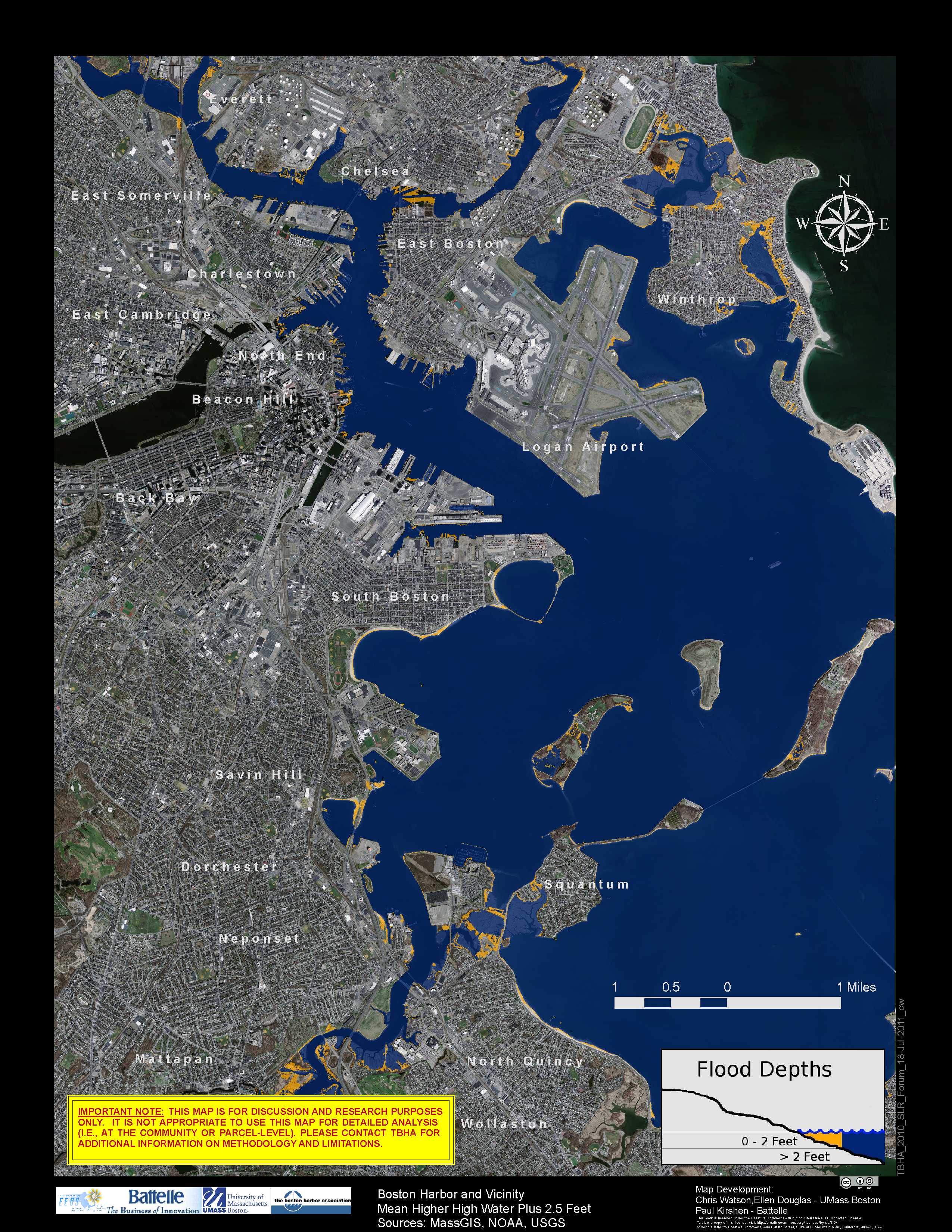
Second, use the map (top right) to find a location near you where we expect flooding to occur. We’re especially looking for photographers to document the shorelines of Everett, Chelsea, East Boston, Winthrop and Revere. We’d also like photos of climate resilient developments (green markers) to illustrate how resilient planning can prevent flooding.
Photos taken between 12 noon and 1 pm will show the most flooding. Try to take pictures where the impact of the tide can be gauged against familiar landmarks like buildings, sidewalks, shorelines, etc. Finally, upload your photos on the MyCoast app and describe any flood damage or other observations you wish to go along with your photo.
We will use this data to help our coastal communities plan and prepare for increasing coastal storms due to climate change through the Resilient Mystic Collaborative (RMC). This voluntary partnership among 16 watershed communities is working on projects of regional significance to help decrease harm from flooding, heat, storms and other climate-intensified risks.
You can also view all of the MA King Tide photos submitted.
We will happily send you a reminder on the morning of the 29th and alert you to other citizen science opportunities. Sign up below:

This flood map—courtesy of Boston Harbor Now, shows the areas most likely to flood (in blue and yellow).
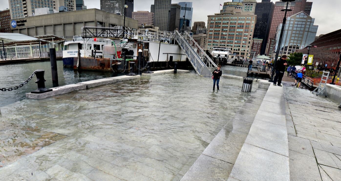
Flooding at Long Wharf (Boston) during a prior King Tide. Courtesy: Northeastern. Click link to zoom/ view 360 photo.


